
Google Earth Community Forum Posts
The heuristic process followed in this discussion was documented in a series of posts to the Google Earth Community, hosted in the Earth and Geography (moderated) forum. A copy of the thread is included here for reference.
March 8, 2012 UPDATE: The Keyhole forum has been migrated into a Google Groups venue. The PDF links below display the topic as it was originally posted.
Download a PDF copy of Forum Posts Page 1
Download a PDF copy of Forum Posts Page 2
Download a PDF copy of Forum Posts Page 3
Download a PDF copy of Forum Posts Page 4
Download a PDF copy of Forum Posts Page 5
In addition, please reference the following additional posts to the forum:
Of Sand Dunes and Carolina Bays
Blythe Bay in Wilmington, NC
The mystery of the Carolina Bays
Embedded Google Earth Viewer Widgets
Link to learn about >>>

The Google Earth facility is a powerful GIS tool which is very "approachable" and intuitive to casual users. Google Earth (GE) can be obtained at GoogleEarth.com. We have an interesting discussion of the Pleistocene - Holocene Boundary and how Google Earth was leveraged in the Inferred Alignment section of the Saginaw Manifold chapter.
The identification of Saginaw ejecta and crater landforms can be accomplished easily using GE. Annotation of each location with structural characteristics and linking information are all easily accomplished. The resulting database can be managed as a structured medadata text file, which is easily distributed to other collaborative users. As we build the database of these elements, we will offer our viewers access to the "Keyhole Markup Language", or KML file. A zipped version , KMZ, of these files are also available. A benefit of the zipped file is that the relevant overlay images can be imbedded in the structure.
Our overlays are quite small and limited in number. The KML version reference internet connections to load the overlays from our central PerigeeZero.org site, while the KMZ will have them imbedded. We offer our collection of KML files on our KML Downloads page.
As an example, we present here composites of an ejecta structures using Google Earth . We show a snapshot here in these pages for your convenience, but we strongly suggest the supplied KMZ file is used with Google Earth to display these mappings. Using GE, the overlay for each landform can be switched on and off to validate the alignment choices we have made.
The process can easily continue, resulting in large numbers of correlation structures. Each addition ejecta signature form adds to the case for the hypothesis. The process can be performed across the globe, with the same startling results. Google earth has become an efficient way for us to organize and access the data sets as they are built and evaluated.
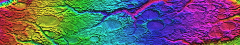
LiDAR Viewer Link
What is the Google Earth API?
The Google Earth Plug-in and its JavaScript API let you embed Google Earth, a true 3D digital globe, into your web pages. Using the API you can draw markers and lines, drape images over the terrain, add 3D models, or load KML files, allowing you to build sophisticated 3D map applications. If you have an existing Maps API site, you can 3D-enable your page with as little as one line of code.
New! Check out the recently revamped Earth API Developer's Guide, covering advanced topics such as KML tours, info balloons, and JavaScript debugging!