

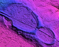

Google Earth Embedded Viewer with Survey KML Shown
This GE Plug-in displays KML which discribes the LiDAR elevation map image of an area of South Carolina. Overlays have been added to higlight the persistent rim planform. These overlays can be processed in our Survey Cacluator, which returns tab-delimited data derived from the planform location, orientaton and size.