

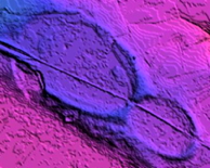


This quad is covered in high quality LiDAR.
The ~1,000 identified bays have an average bearing of 139.87 degrees, with a standard deviation of 3.458.
The kml image is linked to the bay survey for view in Google Earth:
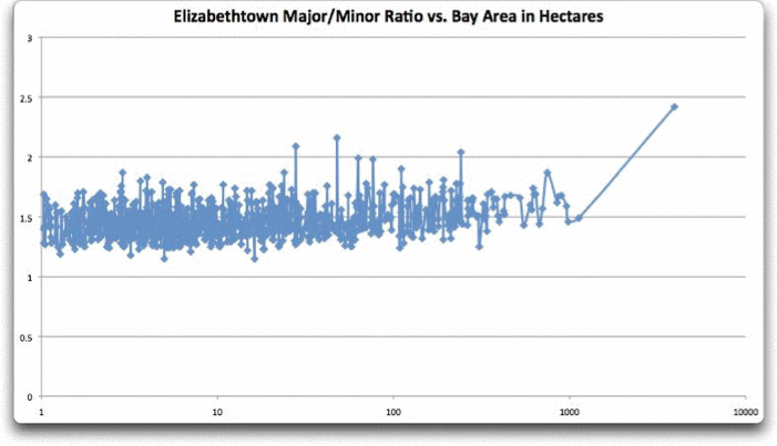
Elizabethtown Bays - Ratio of Major/Minor axis plotted vs bay area size in hectares
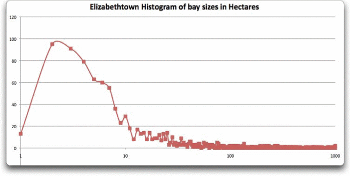
Elizabethtown Bays - Histogram of bay area size in hectares
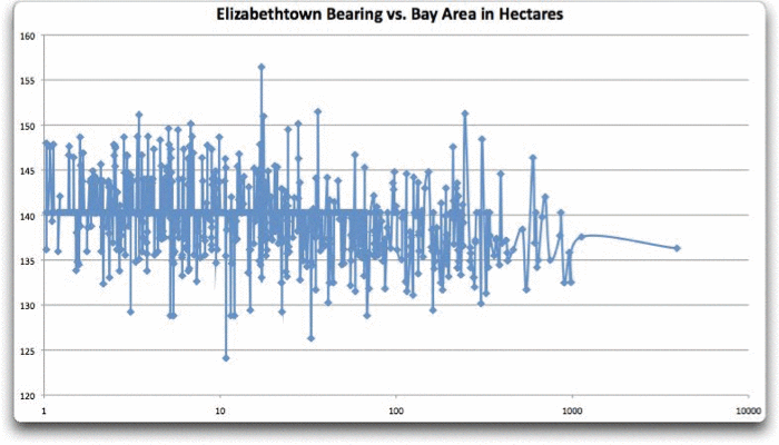
Elizabethtown Bays - Bearing vs Bay Size
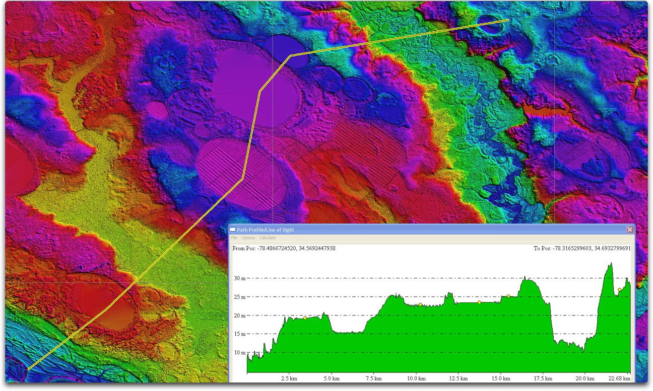
White Lake Elevation Profile (linked to high resolution version)
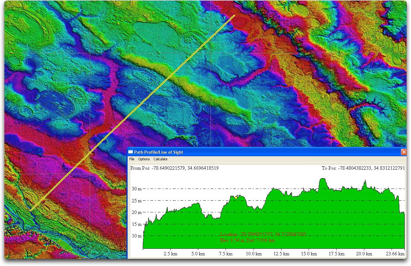
Olin-Tatum Millpond bay Elevation Profile (linked to high resolution version)
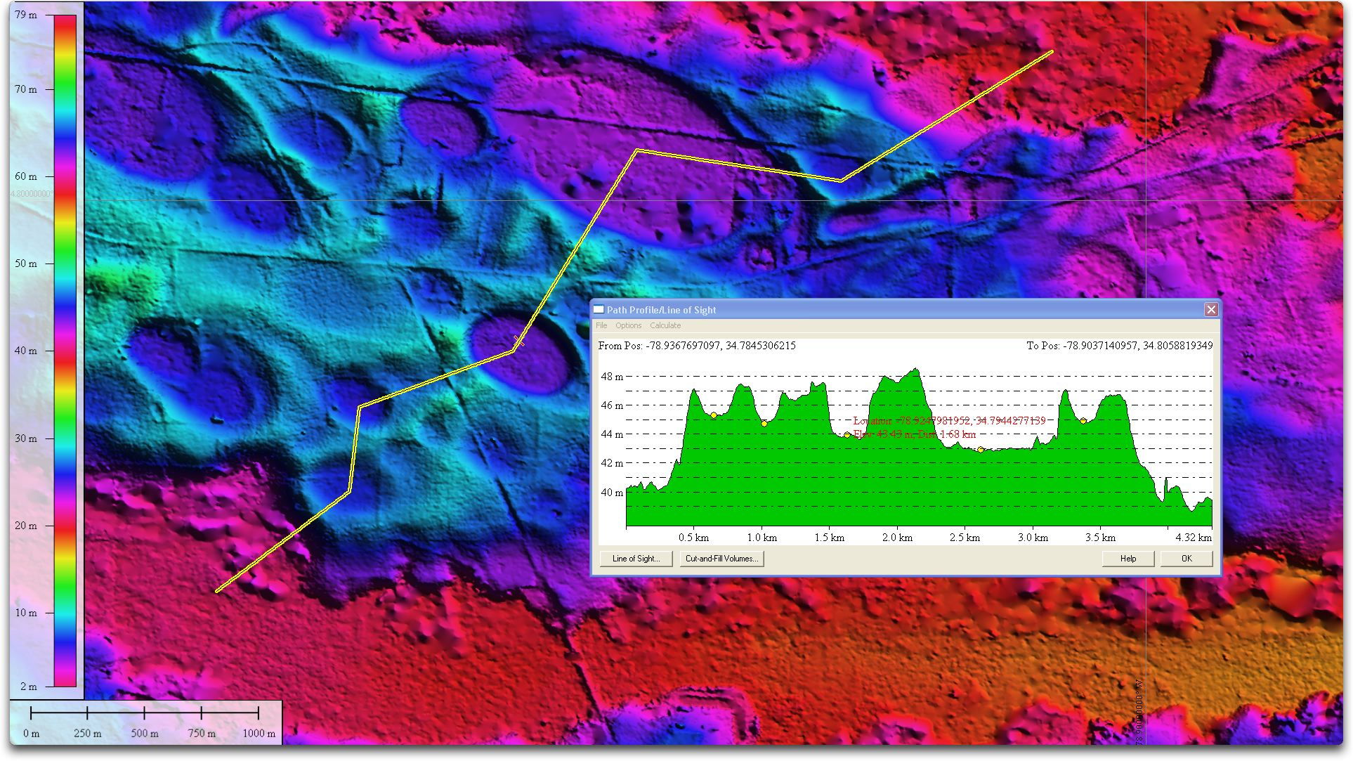
Pretty Pond bay Elevation Profile (linked to high resolution version)
Sample Fusion Table Map Output for Octants
Sample Fusion Table Chart Output for Octants