Gordon Pond, GA
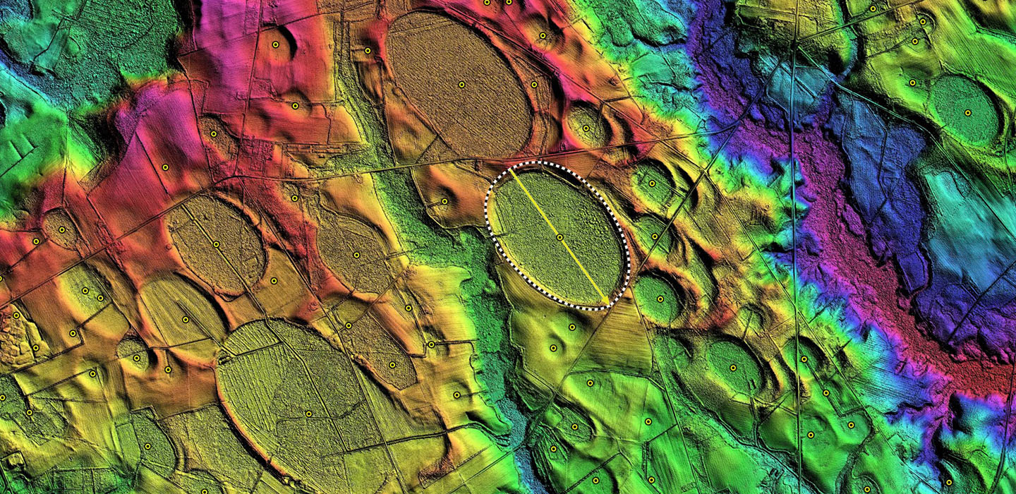
There is a steadily increasing availability of LiDAR-sourced elevation maps from the State of Georgia. The data sets are full LiDAR point clouds, sourced from NOAA, which contain 25cm gridded data. The feature identification is great, so it is easy to remove all the trees and vegetation and get right down to the bare earth. Its designation as a baySouth planform match is robust and satisfactory.
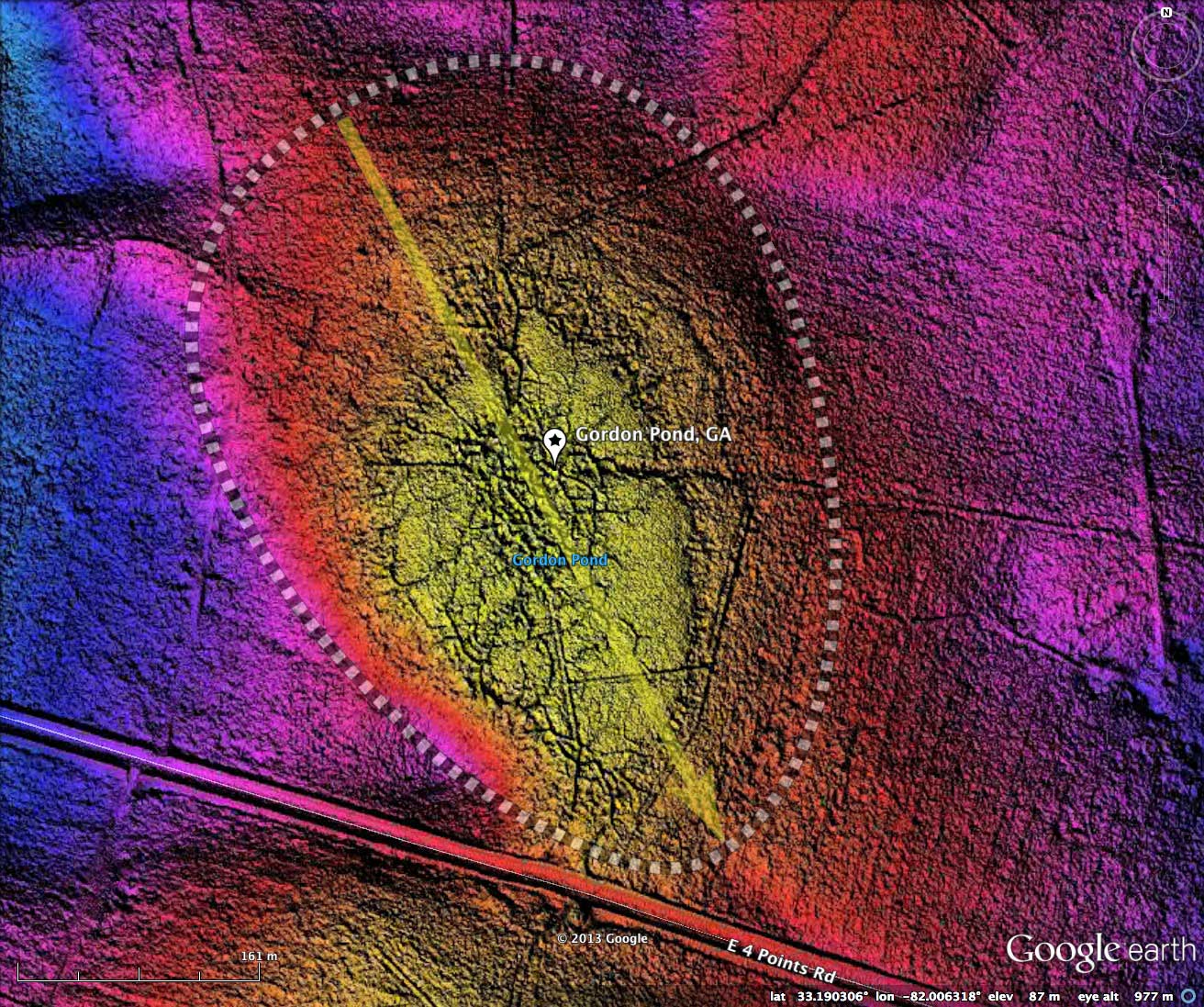
The detailed LiDAR discloses a man-made drainage network across the bay, draining out the low rim to the north. Regardless of the drainage channels, the bay looks to be in a raw, natural state, and may be a candidate for restoration efforts. Having a USGS recognized name as a "Pond" suggest it has held considerable water in the past, and can be seen in the 2/12/1999 Google Earth historical imagery in the attached album.
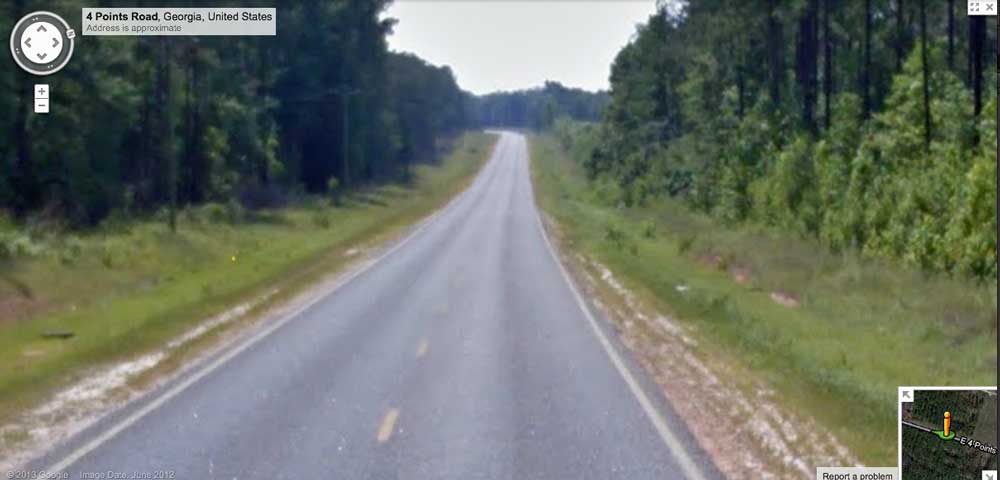
Google Streetview imagery is available along along 4 Points Road, which passes south of the bay.
The image provided in the album show a dip seen in the distance, where the bay drains to the south. The heavy vegetation does not allow a glimpse directly into the bay. You can browse the Streetview interactively with this LINK.
The Carolina Bay Survey has identified and measured 15 bays in Octant 132328. Their location and metrics can be referenced through a Fusion Table spatial visualization.
The detailed LiDAR discloses a man-made drainage network across the bay, draining out the low rim to the north. Regardless of the drainage channels, the bay looks to be in a raw, natural state, and may be a candidate for restoration efforts. Having a USGS recognized name as a "Pond" suggest it has held considerable water in the past, and can be seen in the 2/12/1999 Google Earth historical imagery in the attached album.
Google Streetview imagery is available along along 4 Points Road, which passes south of the bay.
The image provided in the album show a dip seen in the distance, where the bay drains to the south. The heavy vegetation does not allow a glimpse directly into the bay. You can browse the Streetview interactively with this LINK.
The Carolina Bay Survey has identified and measured 15 bays in Octant 132328. Their location and metrics can be referenced through a Fusion Table spatial visualization.
- Index #: 132328_7602
- Location: 33.190173000331086,-82.00635558638854
- Major: 0.57 km . . . Minor: 0.4 km
- Eccentricity: 0.71
- Area: 18.42 hectares
- Bearing: 152.24º
- Elevation: 86.69 m
- Archetype: baySouth
- Effective Diameter: 484.283 m
-
Gordon Pond, GA LiDAR elevation map and bay planform as overlays on Google Earth
-
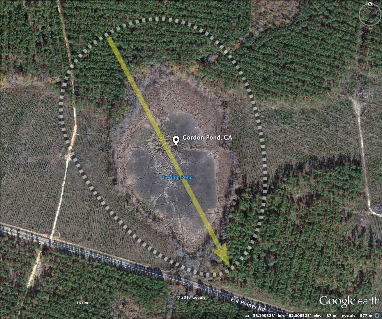
Gordon Pond, GA 2011 Google Earth Satellite Imagery
-
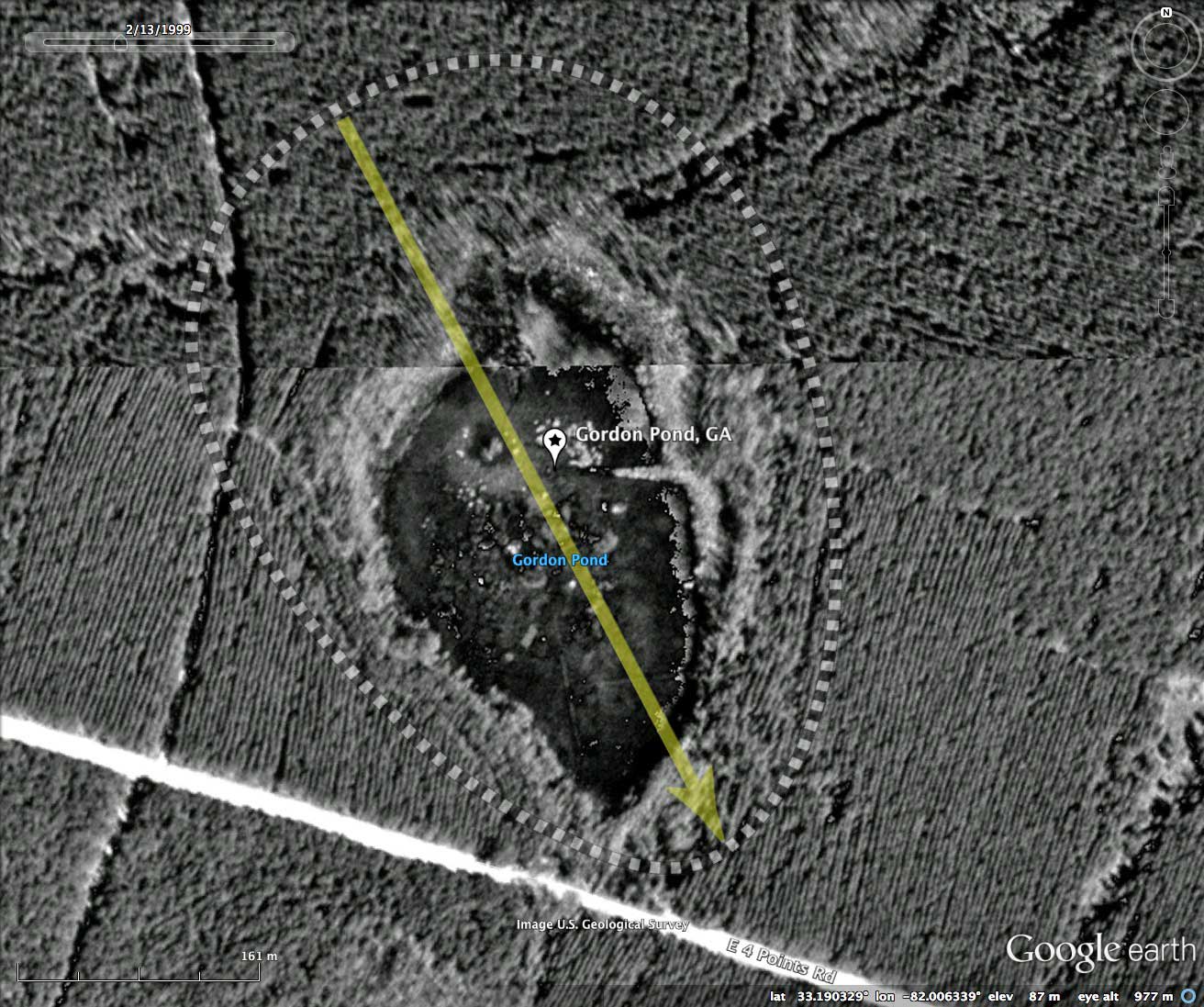
Gordon Pond, GA 1999 Google Historic Imagery
-
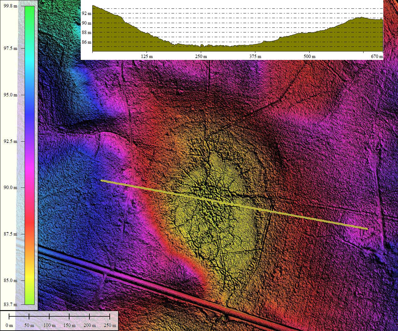
Gordon Pond, GA LiDAR DEM with elevation profile along yellow transect. Created in Global Mapper
-
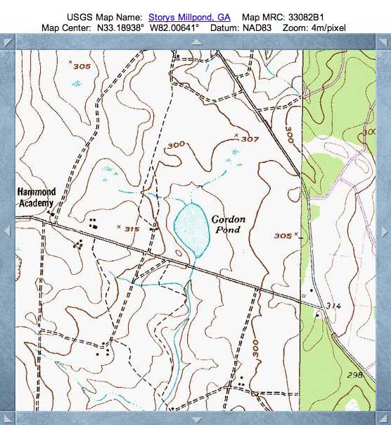
Gordon Pond, GA USGS Topographic Map, sourced from TopoQuest
-
Gordon Pond, GA Google Streetview Imagery showing dip in road as drainage is crossed at souther end of bay.
Copyright 2018 by Michael Davias