Bees Wax Bay, SC
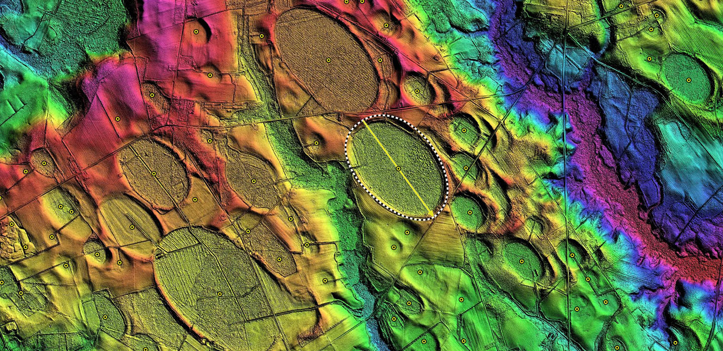
This is a large Bay in South Carolina, with a cute name. I have not identified a reason this is named Bees Wax Bay, but it does carry that name in the USGS Geo-names database. Conforms well to the common bayCarolina archetype, but is beginning to show signs of the more pointed south-eastern tip, as seen in the baySouth archetype.
Two drainage channels cross the bay rim, one at the southeastern tip and another on the eastern flank. Agricultural use seems to be only timber production, except for a small area on the southeastern tip which is open farmland.
The immediate area is covered with smaller bays having a similar shape and orientation. A small dune field extends off the southeastern rim, presenting a terrain which has no correlation to the bay rim structure, and the direction of wind captured in those dunes is certainly not perpendicular to the major axis of the bay.
- Index #: 137320_2431
- Location: 34.31241110422168,-80.07884080963656
- Major: 2.48 km . . . Minor: 1.66 km
- Eccentricity: 0.743
- Area: 324.46 hectares
- Bearing: 145.25º
- Elevation: 63.24 m
- Planform: bayCarolina
- Effective Diameter: 2,032.521
-
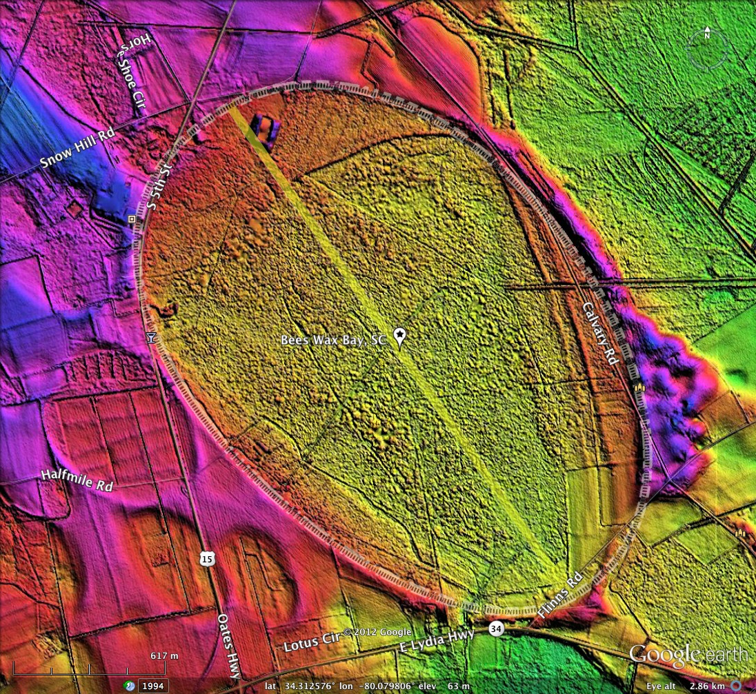
Bees Wax Bay, SC LiDAR elevation map and bay planform as overlays on Google Earth
-
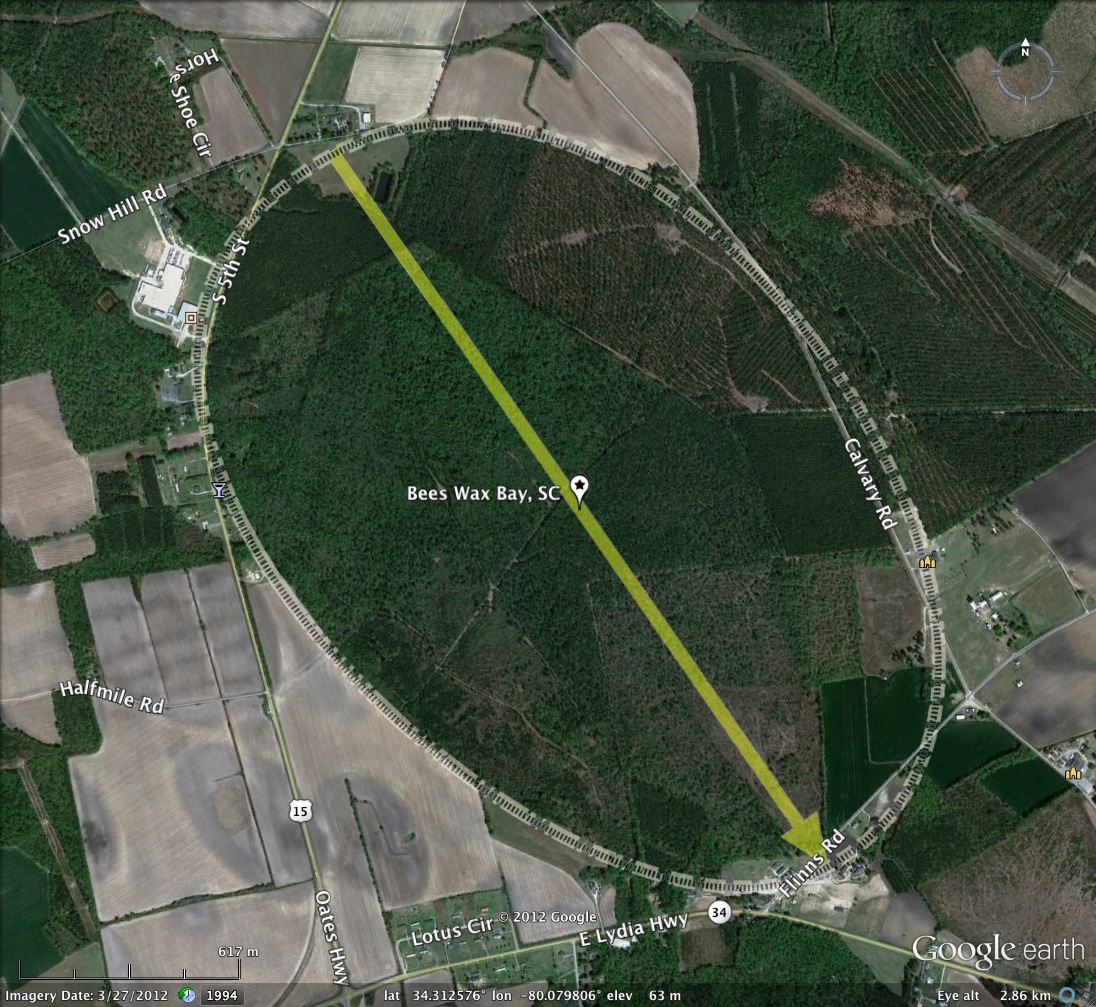
Bees Wax Bay, SC 2012 Google Earth Satellite Imagery
-
Bees Wax Bay, SC 2012 Google Earth Satellite Imagery
-
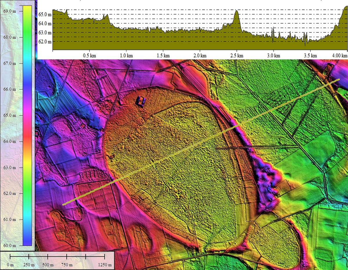
Bees Wax Bay, SC LiDAR DEM with elevation profile along yellow transect. Created in Global Mapper
-
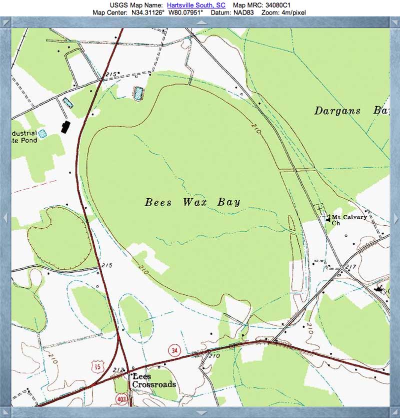
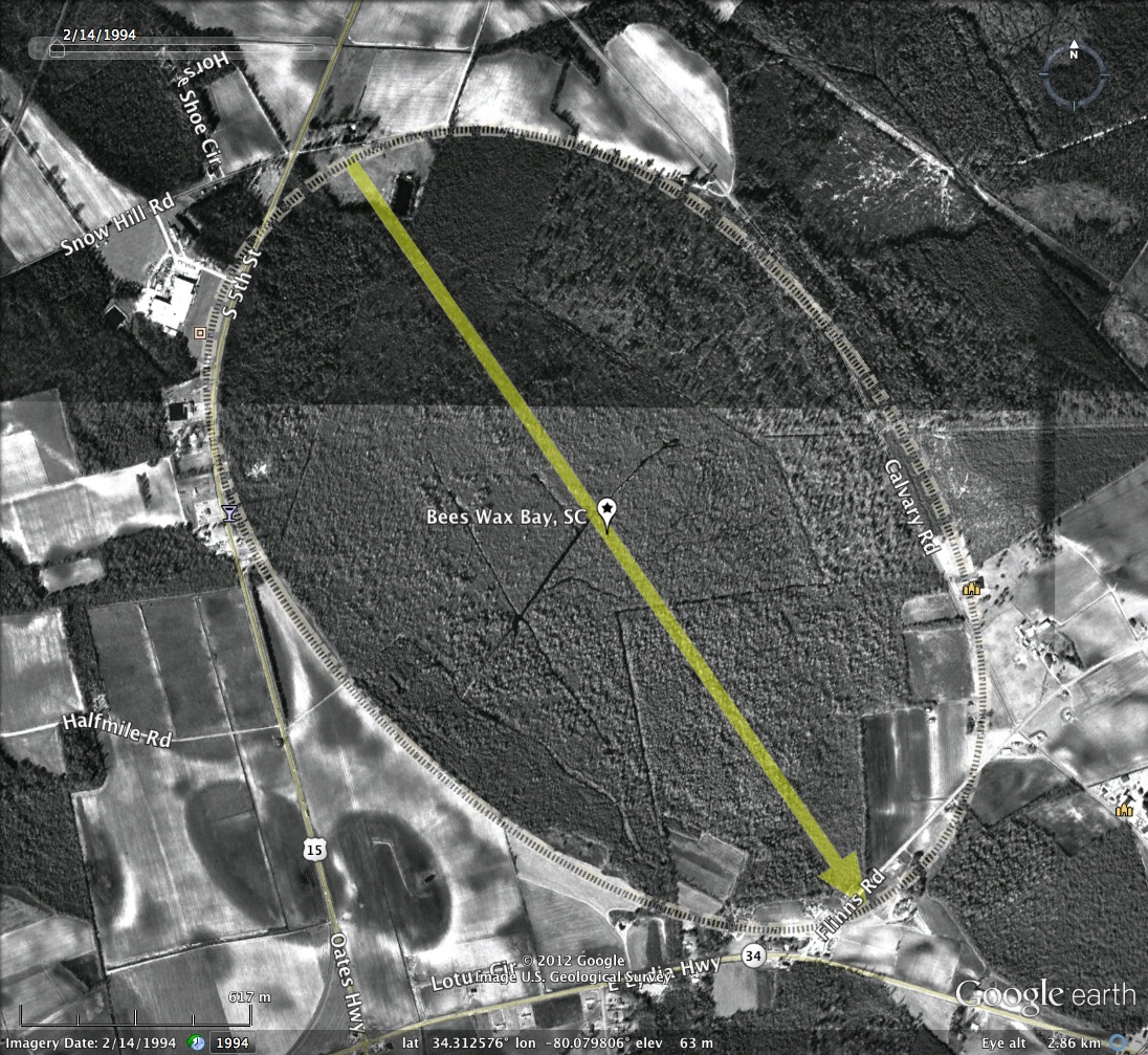
Bees Wax Bay, SC USGS Topographic Map, sourced from TopoQuest
Copyright 2018 by Michael Davias