Chinquapin Road Bay, NC
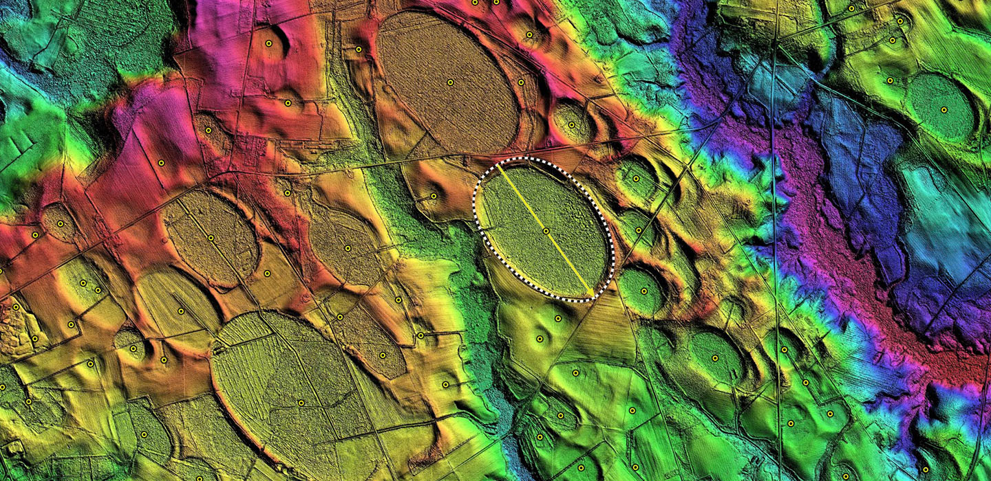
Chinquapin Road Bay's name was derived by me from the local road which wraps around its western rim. It conforms well to the common Bay Archetype shape, and has a bearing which matches others in the local area such as Conetoe Bay to the south.
Two drainage channels have been cut across the rim on the western side, but the bay remains in a fairly natural state. Agricultural land has extended into the bay in the area of the drainage channels, and a large area in the souther end shows it has ben replanted for timber.
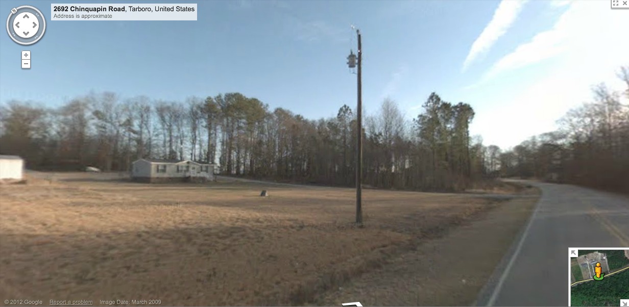
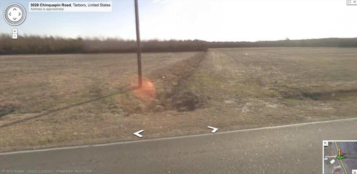
Google Streetview imagery is available along the stretch of Chinquapin Road which runs along its western rim, and drops into and back out of the bay for a stretch along the northwestern end. At that point, one Streetview image in the attached album looks from the roadbed on the bay floor back towards the rim, which is visible behind a home, and also as the road turns to the left and rises to the rim in the distance. In the other Streetview image here, the drainage ditch is shown. See this LINK for your own streetview browsing.
Two drainage channels have been cut across the rim on the western side, but the bay remains in a fairly natural state. Agricultural land has extended into the bay in the area of the drainage channels, and a large area in the souther end shows it has ben replanted for timber.
Google Streetview imagery is available along the stretch of Chinquapin Road which runs along its western rim, and drops into and back out of the bay for a stretch along the northwestern end. At that point, one Streetview image in the attached album looks from the roadbed on the bay floor back towards the rim, which is visible behind a home, and also as the road turns to the left and rises to the rim in the distance. In the other Streetview image here, the drainage ditch is shown. See this LINK for your own streetview browsing.
- Index #: 143309_3684
- Location: 35.84119430299725,-77.4619511817115
- Major: 1.22 km . . . Minor: 0.8 km
- Eccentricity: 0.754988783
- Area: 77.29 hectares
- Bearing: 133.7º
- Elevation: 14.67 m
- Archetype: bayCarolina
- Effective Diameter: 992.01 m
-
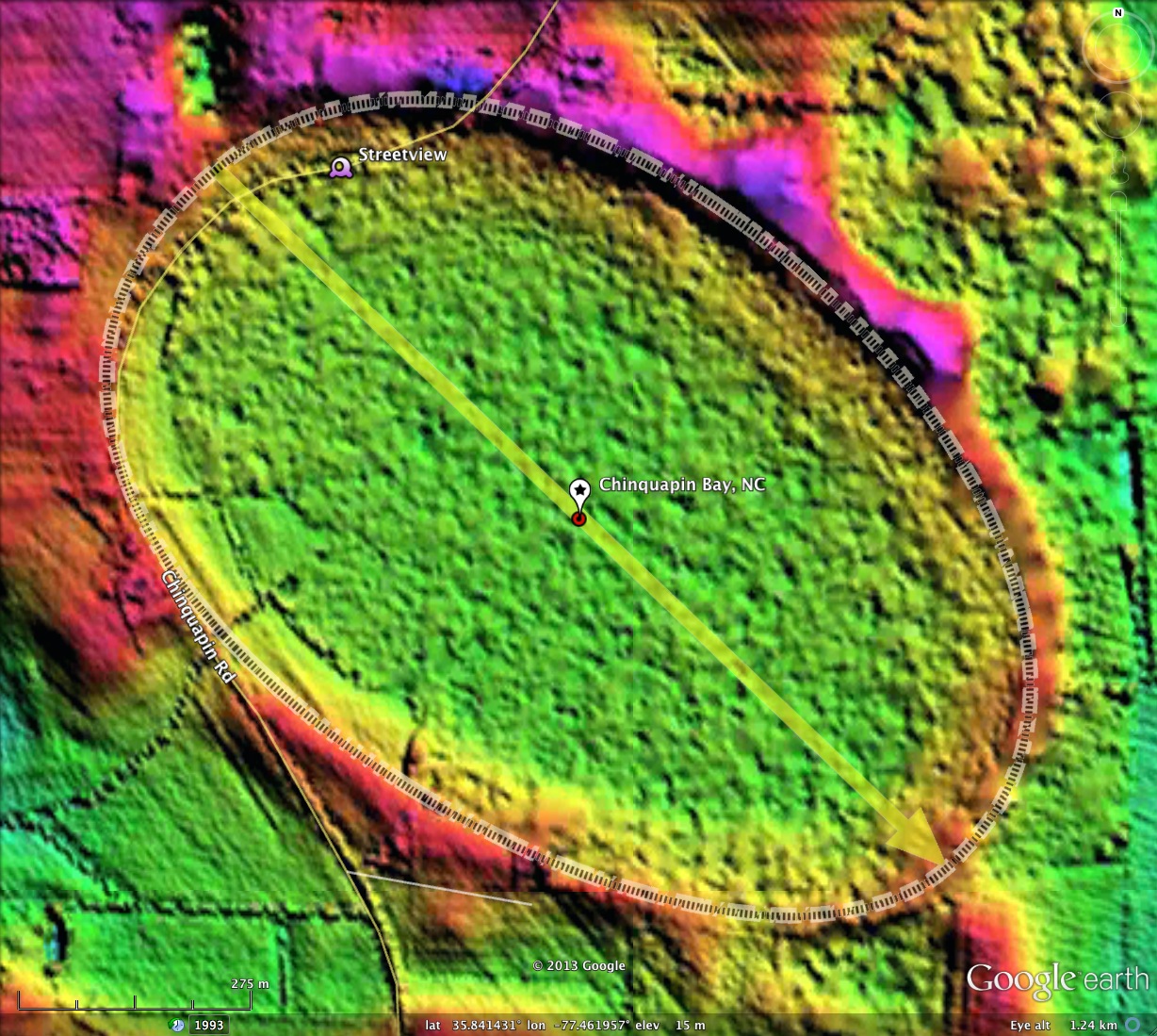
Chinquapin Road Bay, NC LiDAR elevation map and bay planform as overlays on Google Earth
-
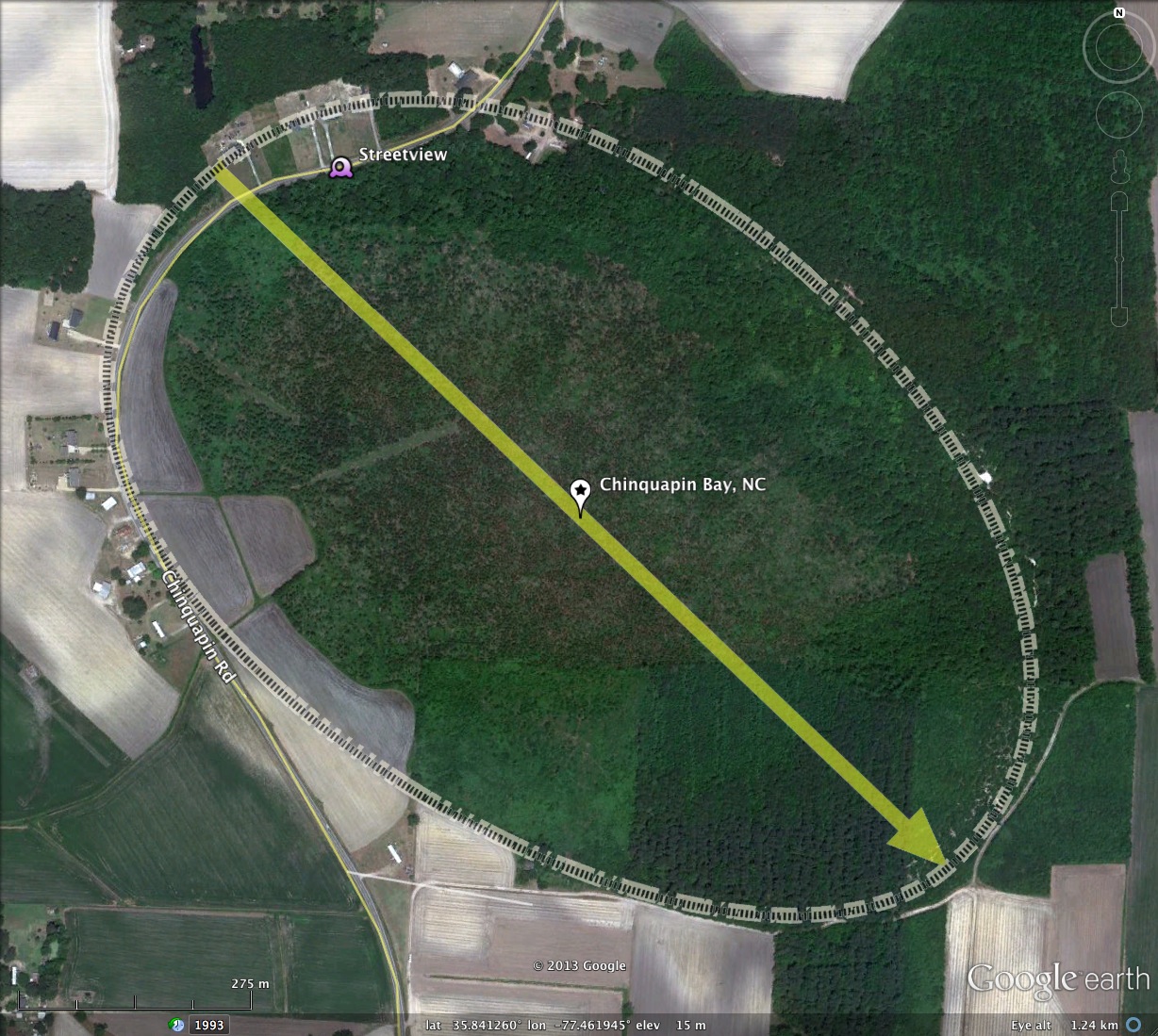
Chinquapin Road Bay, NC 2011 Google Earth Satellite Imagery
-
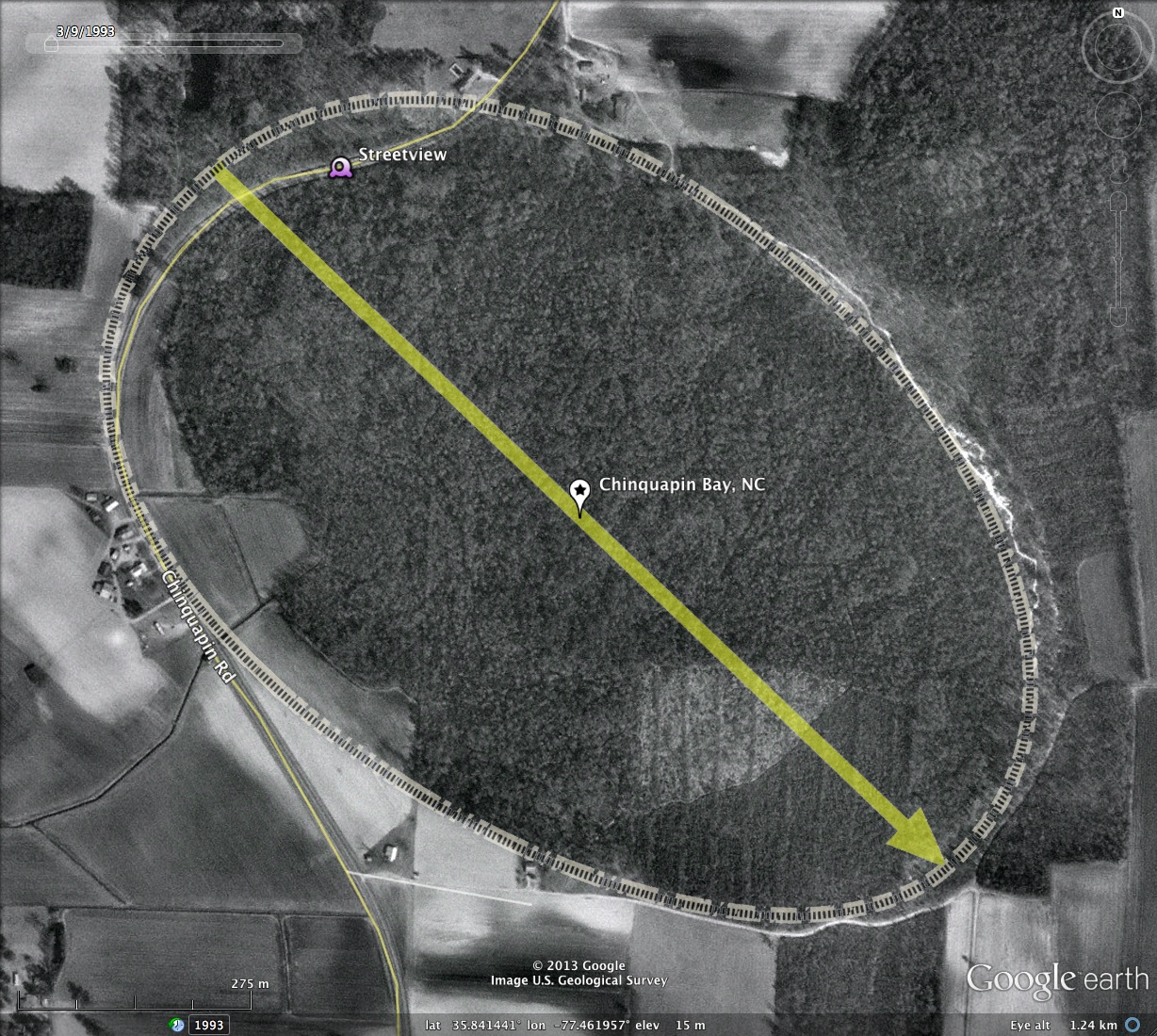
Chinquapin Road Bay, NC 1993 Google Historic Imagery
-
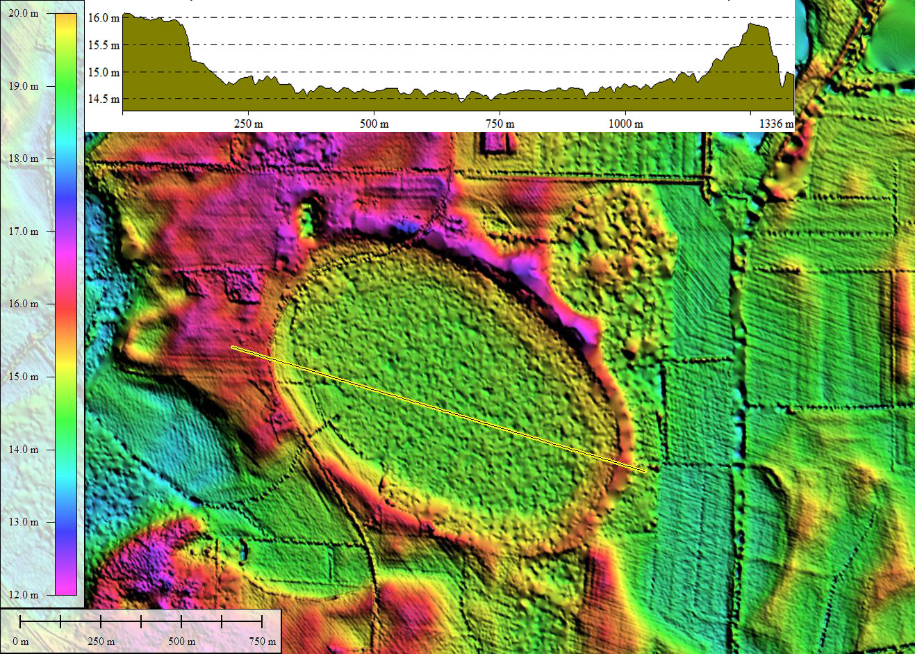
Chinquapin Road Bay, NC LiDAR DEM with elevation profile along yellow transect. Created in Global Mapper
-
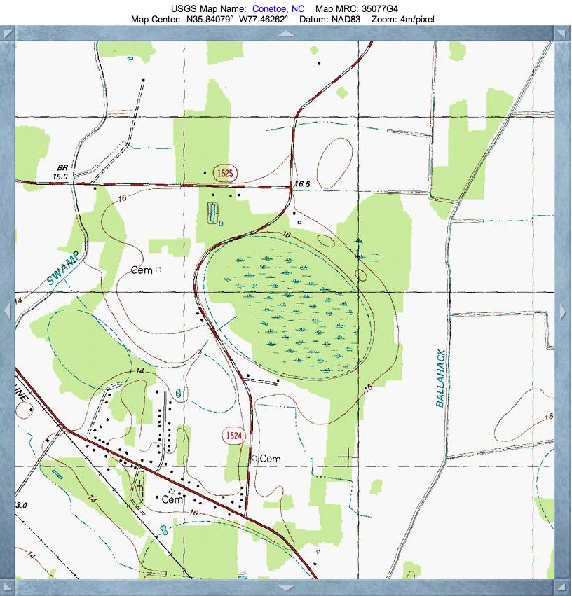
Chinquapin Road Bay, NC USGS Topographic Map, sourced from TopoQuest
-
Chinquapin Road Bay, NC Google Streetview Imagery showing drop into bay from rim on left
-
Chinquapin Road Bay, NC Google Streetview Imagery, drainage ditch is shown
Copyright 2018 by Michael Davias