


This is a collection of Keyhole Markup Language (KML) files for use within the Google Earth GIS Viewer.
KML elements discribing the proposed Saginaw Crater area
Each field's icon can be clicked to bring up an overview of the site. Included in that overview is a link to a KML file containing even more detailed Google Earth elements for visualizing the field.
Example of kml elements available at each field. This Goldsboro, NC field includes the areas covered by R. B. Daniels investigation.
Model-generated set of kml elements describing the walk-back from Carolina bay fields to the proposed crater site
Model-generated set of kml elements describing the predicted orientation at each of the evaluated Carolina bay fields.
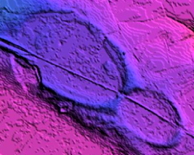
Contains a number of overlay graphics highlighting features of the Saginaw Region of interest in this research
Contains placemarks for ~70 USGS 100K quadrants being searched for bays